
he land reserved for the development of agro-forest, mangrove, riverine and irrigated forest in coastal belt of Sindh have been vanished without monitoring system by the forest department of Sindh Government. Resultantly, the precious natural resources such as; agriculture, livestock, fishries, wildlife species, wood and other livelihood sources stretched from district Thatta to Badin are at the edge of collapse. The mangrove ecosystem of the Indus delta is gravely threatened by the reduced flow of fresh water and its destruction is quite evident in near future if the situation continued to persist for next ten years!
About eight per cent of the total geographical area of Sindh (14.09 million ha), equivalent to some 1.3 million ha, is designated as public forests and rangelands. From the riverine forest area of 0.241 million ha, an area of 90,000 ha (about 35 per cent) was officially reported as blank and covered with sand dunes while about 39,000 ha or 16 per cent contained shrubs and small sized trees suitable for fuel wood only. Most of the remaining area was under the control of landlords.
Owing to political instability and lack of interest by forest department, the riverine and irrigated plantations of Thatta, Badin and Tando Mohammad Khan forest divisions have also recently become a safe haven for the timber mafia.
Riverine forests of Thatta are located on both sides of the Indus over a length of about 145 km and constitute the home of a number of wildlife species including hog deer, wild boar, marsh crocodile and grey and black partridge. Due to indiscriminate gaming and destruction of habitats, many of these species are now endangered.
The riverine forests have also been adversely affected by ever decreasing downstream Kotri flows of freshwater from the Indus. These forests now hardly have any tree growth other than xerophytic species.
About the same is the condition of irrigated plantations over a total area of 15,832.7 acres. The timber mafia has completely erased the best commercial plantations where the current stock stands only on 15 per cent of the total area.
Keti Bandar situated in district Thatta, which used to be a thriving port with a strong agrarian economy, is one of the major towns along the Pakistan coastline that faces environmental degradation and loss of livelihood opportunities for locals. The sea has so far engulfed 28 dehs (cluster of villages) out of the total 42. The total area affected by the sea intrusion is 46,137 hectares.
The poorest in terms of flora among the four target areas, with a total of 117 species, most of them salt-tolerant plants. In the creek mangrove ecosystem, Avicennia marina was found to be SEA erosion is fast destroying the mangrove ecosystem in Keti Bandar.
The report warns that if certain quantity of fresh water was not allowed to go into the delta, “the mangrove ecosystem of the Indus delta would be destroyed in near future, depriving the country of all its fishery resources and livelihood of local people, who would be forced to migrate”. The forest resources of Badin district are rather limited. There are only two government controlled inland forests/irrigated plantations at Buharki and Rari, over an area of 7,111.3 ha and 4,949.8 ha, respectively.
The Rari forest, which is spread over 12,000 acres of land in the Shaheed Fazil Rahu taluka, is known for its greenery. But due to negligence on part of forest officials, the forest is rapidly vanishing as influential people are chopping trees and using the fertile forest land for agriculture purposes.
These irrigated plantations are very poorly stocked, and only 4.1 per cent or 499.9 ha of their total area have any trees, while large portions are affected by salinity and water-logging.
The last remaining mesquite growth in these inland forests is also being cut and converted into coal for sale mainly in the Punjab markets.
Whereas, in Tando Muhammad Khan there are six coastal area inland plantations in this division, spread over about 7500 ha, are Penah, Huderani, Mulchand, Hazari, Surjani and Ganj. After the construction of Kotri Barrage in 1954, an assured seasonal water supply was sanctioned for these plantations at the rate of 13.3 cusecs for 404.6 ha or one cusec for 32 ha, during Kharif season.
The water shortages have recently been of the order of 82 per cent, thereby causing serious damage to the newly-planted blocks and other existing stocks. The best of these inland plantations (developed under the ADB-supported Sindh Forestry Development Project), have been illegally cut and sold recently.
Rangelands in Jamshoro and Thatta districts, specially those located on the Superhighway and National Highway, are effectively controlled and utilized by upcountry business concerns, recreational farm houses and estates of urban land mafia and industrialists in connivance with the Sindh board of revenue and political elite.
Mining of water thus occurring from a region of precarious water balance is a serious environmental and livelihood threat to the local population.
At present, less than 20 per cent of mangroves, riverine and inland forest areas are covered with adequate tree growth. Due to inadequacy of forest resources, rural communities living in the immediate vicinity of forests are experiencing rising poverty with the passage of time.
Availability of resources for grazing of their livestock, firewood for cooking, and timber for agricultural implements, house construction and thatching material is continuously decreasing.
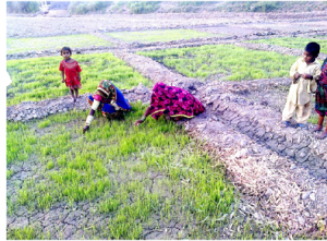
Enough fresh water from the river Indus is not reaching the deltaic creeks, which adversely affects agriculture, livestock, mangroves, fisheries and other livelihood sources.
It would be an uphill task if the existing riverine plantations and wildlife species are saved and properly managed. The option of agro-forestry by adjoining farmers and encroachers is also questionable, keeping in view better alternate uses of limited freshwater in cultivating high value crops coupled with tendency of illicit tree cutting and evasion of lease money and taxes.
Irrigated plantation areas can be replanted with babul and eucalyptus by ensuring the availability of sanctioned irrigation water from the left bank and right bank canals of Kotri Barrage at the rate of one cusec per 32 ha.